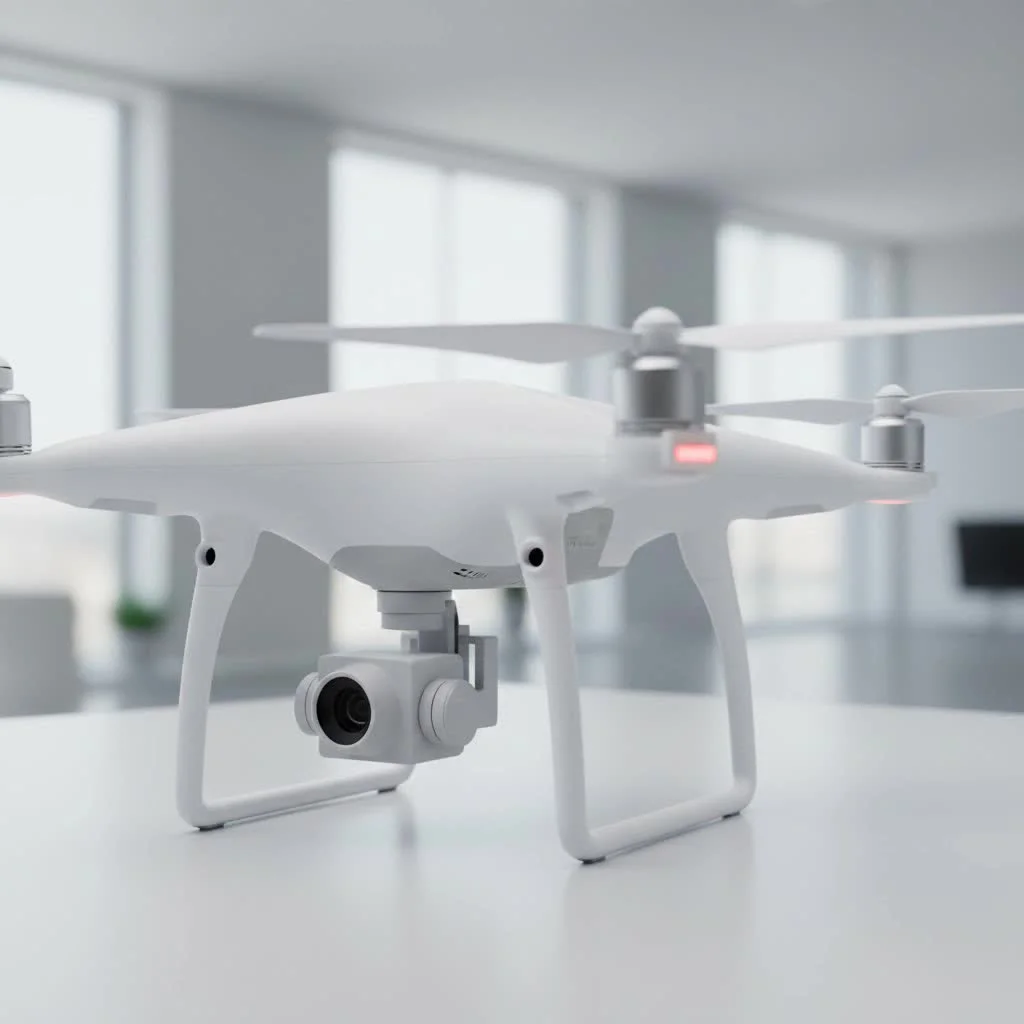
Drone surveying utilizes Unmanned Aerial Vehicles (UAVs) equipped with high-resolution cameras or advanced sensors like LiDAR to capture precise geospatial data from the sky. This method fundamentally transforms land surveying by offering significant improvements in speed, cost-efficiency, safety, and data accuracy compared to traditional ground-based techniques. For instance, a survey that might take weeks on foot can often be completed by a drone in a matter of hours, covering hundreds of acres.
What Exactly is Drone Surveying?
At its core, drone surveying involves a drone outfitted with high-resolution cameras or advanced sensors, such as LiDAR, to collect aerial data of a specific area. This process goes beyond simple aerial photography; it’s a sophisticated method of data collection that, through specialized software, converts thousands of images or data points into detailed, measurable outputs. The primary technologies driving this are:
- Photogrammetry: This is the science of making measurements from photographs. In a drone survey, the UAV flies a pre-planned grid pattern over a site, capturing hundreds or thousands of overlapping images. Photogrammetry software then analyzes these images, identifies common points, and stitches them together to create a geographically accurate, high-resolution 3D map or model.
- LiDAR (Light Detection and Ranging): Some survey drones are equipped with LiDAR sensors. These sensors emit rapid pulses of laser light towards the ground. By measuring the time it takes for each pulse to reflect, the system calculates a precise distance. This process creates a “point cloud,” an incredibly detailed 3D data set that can even penetrate vegetation to map the true ground surface.
From these raw data captures, a wealth of valuable assets can be generated, including 2D orthomosaic maps, 3D point clouds, Digital Elevation Models (DEMs), and detailed topographic contour lines.
Why Use Drones for Surveying? The Key Benefits
The shift from traditional methods to drone surveying is driven by tangible advantages that impact project timelines, budgets, and safety protocols. These benefits are so significant that they are reshaping industry standards.
Unmatched Speed and Efficiency
One of the most profound benefits is the dramatic reduction in time. A land survey that might take a team weeks to complete on foot can often be accomplished by a drone in a matter of hours. A single flight can cover hundreds of acres, capturing data far more rapidly than any ground-based crew. This speed accelerates project timelines, allowing for faster decision-making and quicker project turnaround.
Significant Cost Reduction
By reducing fieldwork hours and minimizing the need for large survey teams, drones offer substantial cost savings. The operational costs of a UAV are significantly lower than mobilizing a full ground crew with expensive, heavy equipment. This efficiency makes frequent surveying—for progress monitoring on construction sites, for instance—not just possible but economically viable.
Enhanced Safety
|
Our Picks for the Best Drone in 2026
As an Amazon Associate I earn from qualifying purchases.
|
||
| Num | Product | Action |
|---|---|---|
| 1 | Drone with Camera 1080P HD FPV Foldable Drone for Adults and Beginners, RC Quadcopter with Gravity Control, One Key Take Off/Land, Optical Flow Positioning, 360° Flip, 3 Speed Mode, Waypoint Fly Grey |

|
| 2 | DJI Neo, Mini Drone with 4K UHD Camera for Adults, 135g Self Flying Drone that Follows You, Palm Takeoff, Subject Tracking, QuickShots, Stabilized Video, Built-In Propeller Guard (Controller-Free) |
|
| 3 | LỖI |
|
| 4 | DJI Mini 3 Fly More Combo (DJI RC), Drones with Camera for Adults 4K, 3 Batteries for 114-min Flight Time, Vertical Shooting, 32800ft (10km) Video Transmission, Lightweight Mini Drone for Beginners |
|
| 5 | DJI Mini 5 Pro Fly More Combo with DJI RC 2, Drone with Camera, 1-Inch CMOS, 4K Drone for Beginners with Omnidirectional Obstacle Sensing, ActiveTrack 360°, 225° Gimbal Rotation, 3 Batteries |
|
| 6 | Drone with Camera - Drones for Adults, with 2 Batteries, Carrying Case, Propellers, 1080P HD Foldable Drone with Stable Hover, Trajectory Flight, Gravity Control, One Key Take Off/Land, 3D Flip |
|
| 7 | Drone with 1080P Camera for Beginners and Adults, Foldable Remote Control Quadcopter with Voice Control, Gestures Selfie, Altitude Hold, One Key Start, 3D Flips, 2 Batteries, Toy for Beginners |
|
| 8 | DJI Neo Three-Battery Combo, Mini Drone with 4K UHD Camera for Adults, 135g Self Flying Drone that Follows You, Palm Takeoff, Subject Tracking, QuickShots, Stabilized Video (Controller-Free) |
|
| 9 | DJI Mini 3 (DJI RC), Lightweight 3x Mechanical Gimbal Drones with Camera for Adults 4K, 38-min Flight Time, up to 32800ft (10km) Video Transmission, Vertical Shooting, GPS Auto Return Integrated |
|
| 10 | Drone with Camera for Adults, 2K HD FPV Drones with Upgrade Altitude Hold, One-Key Take Off/Landing, Speed Adjustment, Headless Mode, 2 Batteries, Toys Gifts for Teen Boys Girls, Beginner |
|
Surveying can be hazardous. Job sites often include difficult-to-reach areas, unstable terrain, steep slopes, or active industrial operations. Drones eliminate the need for human surveyors to physically access these dangerous locations. By collecting data from a safe distance, UAVs drastically reduce the risk of accidents and injuries, creating a safer working environment for everyone involved.
Superior Data Accuracy and Detail
Modern survey drones, especially those equipped with RTK (Real-Time Kinematic) or PPK (Post-Processed Kinematic) GPS technology, can achieve survey-grade accuracy down to the centimeter level. The sheer volume of data points collected provides a far more comprehensive and detailed picture than traditional methods might capture. This high-density data leads to richer 3D models and more precise measurements, giving engineers and project managers greater confidence in the results.
“With traditional surveying, you collect data points one by one. A drone, in a single flight, captures millions of data points. You’re not just getting a sample of the site; you’re getting the entire site in high-resolution detail. It’s a major upgrade for accuracy.” – Dr. Alistair Finch, RVSWS Geospatial Analyst
How Does Drone Surveying Work?
While the technology is complex, the workflow for a typical drone survey follows a logical three-step process, turning a flight into actionable intelligence.
Step 1: Mission Planning
Before the drone ever leaves the ground, the mission is meticulously planned. Using specialized software, the surveyor defines the project area, sets the required resolution (which determines the flight altitude), and plans the automated flight path—typically a grid pattern to ensure sufficient image overlap. Factors like terrain, weather conditions, and airspace regulations are all considered.
Step 2: Data Acquisition (The Flight)
Once on-site, the surveyor may place Ground Control Points (GCPs)—marked targets with known coordinates—to further enhance accuracy. The drone is then launched and executes the pre-programmed flight path autonomously. During its flight, it captures the necessary data, whether it’s high-resolution images for photogrammetry or laser pulses from a LiDAR sensor.
Step 3: Data Processing
After the flight, the collected data is uploaded to a powerful processing engine. This is where the magic happens. The software analyzes the data, geotags each image or point, and constructs the final outputs. This can take anywhere from a few hours to a day, depending on the size of the dataset. The result is a suite of digital assets ready for analysis, measurement, and integration into design software like CAD or GIS.
Common Applications of Drone Surveying
The versatility of drone surveying has led to its adoption across a wide range of industries, each leveraging the technology for unique purposes.
- Construction: Drones are used for everything from initial site surveys and topographic mapping to monitoring construction progress, calculating earthwork volumes (cut/fill analysis), and conducting as-built surveys.
- Mining: In mining operations, drones provide a safe and efficient way to map stockpiles, measure volumes, monitor pit walls, and plan blast operations.
- Agriculture: Farmers and agronomists use drones for crop monitoring, assessing plant health with multispectral sensors, and creating precise elevation maps for irrigation and drainage planning.
- Land Management and Environmental Monitoring: Drones help in monitoring land use changes, tracking erosion, mapping floodplains, and conducting wildlife habitat assessments without disturbing the natural environment.
Frequently Asked Questions (FAQ)
What is the difference between drone surveying and traditional surveying?
Traditional surveying relies on ground-based equipment and physical measurement by surveyors on foot, collecting individual data points. Drone surveying uses an aerial platform to capture millions of data points quickly and remotely, creating a comprehensive digital model of the entire area.
How accurate is drone surveying?
With professional-grade equipment, including RTK/PPK enabled drones and the proper use of Ground Control Points (GCPs), drone surveying can achieve accuracy down to a few centimeters, making it suitable for most commercial and engineering applications.
What is LiDAR in drone surveying?
LiDAR is a remote sensing method that uses pulsed laser light to measure variable distances to the Earth. In drone surveying, a LiDAR sensor can create highly detailed 3D point clouds and is particularly effective at mapping ground surfaces beneath vegetation canopies.
Do you need a license for drone surveying?
Yes, in most countries, operating a drone for commercial purposes, including surveying, requires the pilot to be certified or licensed by the national aviation authority (such as the FAA in the United States).
How much does drone surveying cost?
The cost can vary widely depending on the size and complexity of the site, the required accuracy, and the type of deliverables. However, it is generally more cost-effective than traditional surveying methods, especially for large areas, due to the significant reduction in time and manpower.
The Future of Surveying is in the Sky
Drone surveying is no longer a futuristic concept; it is the present reality. By delivering data faster, safer, and more affordably than ever before, this technology has firmly established its place as an essential tool in the surveyor’s toolkit. As drone and sensor technology continues to advance, its capabilities will only expand, promising even greater accuracy, efficiency, and insight. For professionals in construction, mining, agriculture, and beyond, embracing drone surveying is not just about keeping up with trends—it’s about unlocking a smarter, more data-driven way to build and manage the world around us.
Frequently Asked Questions
What is the fundamental difference between drone and traditional surveying?
Traditional surveying relies on ground-based equipment and physical measurements by surveyors, collecting individual data points. Drone surveying, conversely, uses an aerial platform to capture millions of data points quickly and remotely, creating a comprehensive digital model of an entire area.
How precise can drone surveying be for commercial projects?
With professional-grade equipment, including RTK/PPK enabled drones and the proper use of Ground Control Points (GCPs), drone surveying can achieve accuracy down to a few centimeters. This level of precision makes it suitable for most commercial and engineering applications, providing reliable data for critical decisions.
What role does LiDAR play in modern drone surveying?
LiDAR (Light Detection and Ranging) is a remote sensing method that uses pulsed laser light to measure variable distances to the Earth. In drone surveying, a LiDAR sensor creates highly detailed 3D point clouds and is particularly effective at mapping ground surfaces beneath vegetation canopies, offering superior data in challenging environments.
Is a special license required to operate a drone for commercial surveying?
Yes, in most countries, operating a drone for commercial purposes, including surveying, requires the pilot to be certified or licensed by the national aviation authority. For example, in the United States, pilots must obtain certification from the FAA.
How does the cost of drone surveying compare to traditional methods?
The cost of drone surveying can vary based on site size, complexity, and required accuracy. However, it is generally more cost-effective than traditional surveying methods, especially for large areas, due to significant reductions in time and manpower needed for data collection and processing.
How to Conduct a Drone Survey
Learn the three essential steps for performing an effective drone survey, from initial planning to final data processing.
Before any flight, use specialized software to define the project area, set the required resolution, and plan an automated flight path, typically a grid pattern. Consider terrain, weather, and airspace regulations to ensure a safe and effective mission.
On-site, place Ground Control Points (GCPs) if needed to enhance accuracy. Launch the drone to autonomously execute its pre-programmed flight path, capturing high-resolution images for photogrammetry or laser pulses from a LiDAR sensor. Ensure all data is collected as planned.
After the flight, upload the collected data to a powerful processing engine. The software will analyze, geotag, and construct the final outputs, which can take several hours to a day. The result is a suite of digital assets ready for analysis and integration into design software.
Get our weekly buyer guide
Practical specs, not advice. Unsubscribe anytime.
I’ve been using drones for property inspections for a while, but the detailed explanation of LiDAR in this post really opened my eyes. The accuracy it provides for elevation mapping is just incredible. My clients are consistently impressed with the detailed topographical maps I can now deliver, and it’s definitely saved me a ton of time compared to older methods.
Safety is a huge factor for our construction projects, and the point about drone surveying significantly improving safety compared to traditional ground-based techniques really resonated with me. Avoiding sending personnel into hazardous or hard-to-reach areas is invaluable. Plus, the data accuracy we get from the high-resolution cameras is fantastic for progress tracking.
Good info on how drone surveying works. I was hoping for a bit more detail on specific software recommendations for processing the thousands of images into usable data. It mentions specialized software, but a few brand names or types would have been really useful for someone just getting started. Still, it’s a solid overview of the benefits.
This was a super helpful breakdown of drone surveying. I’m a civil engineer, and the speed at which a drone can cover hundreds of acres is a game-changer for preliminary site assessments. My only minor gripe is that the initial setup cost for a good LiDAR-equipped drone can be pretty steep, but the long-term efficiency gains definitely make it worth it.